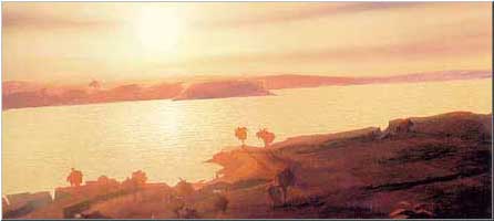
River Styx

Also called Nilus or Nile by Howard, the greatest river of the Hyborian world-continent. It is said to spring from sources far in the unknown lands south of Stygia; then it runs north for "a thousand miles" before it turns and flows westward "for hundreds of miles" and ultimately empties into the Western Ocean.
If we accept the scale of the original Kyle map that superimposed modern continents upon that of the Hyborian Age, we discover that Howard suffered one of his most notable lapses in perspective when he described this river. (Or perhaps he referred to Hyborian leagues, not miles.) Its north-flowing section is seen to be at least 1500 miles long; after the Big Bend, the Styx flows westward for some 2000 miles before reaching the sea.

The river forms the boundary between Shem and Stygia and between Punt and Keshan. The mouth of the river is a huge estuary, several miles wide, with black-walled Khemi guarding the Stygian side. Just east of Khemi, the river breaks into numerous channels, reedy byways, and lagoons. Hills and cliffsides mark the northern bank of the river.
The Stygian side is mostly snake-infested marshes. The hippopotamus and cocodrill creep in its swampy shallows. Beyond Black Lotus Swamp, the river dwindles at times to a none-to-broad channel confined by reed and willow banks, shallow enough in places for an army to ford. Locals speculate that the river's deepest currents run through underground caverns, since past this area the river swells back to a broad artery of commerce. Here the Stygian marshes give way to irrigated lands planted in vast tracts of grain, onion, papyrus, and palm.
Harakht and other great cities can be seen lying a days trek or more inland. The Styx in this area is dotted with many islands; some with ruined temples, noble estates, and the occasional river-port. It has a ford at Bubastes near the tributary Bakhr River and is crossed by ferries at many other points.
Once past Luxor, the Styx becomes broader and less treacherous. The Shemitish side is dry meadowland, while the Stygian side is pale bedrock and drift sand. The south bank is a parched land, with no farm or inhabited cities, only isolated, crumbling ruins. Further upstream, meadows, orchards, and cultivated bottomlands spring once again from the river's mud. At long last, the Shemitish city-states are left behind, as the river narrows and meanders through broad gorges walled by steep precipices and rainbow ribbed hills. The river runs past Erkulum and the rock-fanged mouth of the Helu River.
The river is so wide that it's right turn south is barely noticed. It travels south past sheer-walled river oases, caverns cut deep under mountains, and the crimson-faced temple-tombs of Qarnak. It crosses the Ellobolu, a narrow lake rumored to be bottomless. Beyond are more bends and convolutions in a wilder, less inhabited Styx. The few towns, fortified outposts, and ferry-crossings cling between the black river and the barren hills.
Past an island fortress, southward canyons open out into a broad, shallow reach of river, whose steep west bank boasts a stone-walled caravan river-town. It is beyond here that he Styx comes thundering down a steep canyon in a series of impassable falls and rapids. To the west of the falls, in the hilly region over the ridge, lies a hot-spring lake, claimed by the Stygians as being the source of the Styx's miraculous waters. In actuality, the lake's outflow feeds a tributary stream of the great river.
Above the falls, the Styx traverses a brushy plateau, with dry hills away to the east. Here there are no great cities, only bricked-walled, riverside towns and the occasional ruined stone temples, ruptured tombs of the serpent-race.
Upriver from Stygia, the river's aspect changes. Riverbanks grow wild with impenetrable wood and thickets. The Styx's course meanders in broad, looping curves. One hundred leagues south, along the border of Keshan, lies the Grand Gorge of the River Styx. This stretch of the river is totally impassable, full of waterfalls and numerous whirlpools and rapids. Two days travel upstream, the Styx becomes a large, sodden swamp, literally taking a week or better to sail through it.
At last, the disease-ridden swamp gives way to open slough, then dense forest. The river becomes a black canal walled by curtains of impenetrable brush and vine, and tropical jungles teeming with birds and monkeys. At long last, the river runs up against a truly staggering obstacle, a waterfall that falls in ribbons over a half a league down a fern-lined cliff-face.
On the plateau above the waterfall, the Styx runs swift and clear through a large, animal-filled veldt. In the middle of this open, airy basin, the river splits into nearly equal-sized forks, one running in a westerly direction, the other due south. The west fork has only been explored a hundred leagues or so, ending at a black-inhabited city standing atop a bluff above the river. This unidentified city has sturdy brick walls and high towers.
The inhabitants of Punt call the southern fork of the Styx "Waputan". For several hundred leagues, the Styx passes through the sparsely inhabited grasslands and forests, thorny thickets and reed lakes of Punt. The south branch ends at a vast rampart of snow-covered volcanoes called the Mountains of Jukala. But in the end, the ultimate sources of the River Styx were the equatorial rain forests.
References: Hyborian Age I, Tower of the Elephant, Queen of the Black Coast, A Witch Shall Be Born, Lord of the Black River, Hour of the Dragon, Black Sphinx of Nebthu, Red Moon of Zembabwei, Conan the Bold.
